Get the natural perspective of the events happening

Global and Indian News always strives to provide impassionate and truthful information about the events happening aroudn the world. Readers dont have to go anywhere else for reading the information

Read from the horse mouth

Information gathered are cross checked before displaying in the site

Always strike a balance while preparing the news contents

The news found in this site are always well balanced and neutral

At times, the authors views are also seen in the news topics

In important topics, the individual views of the author and people are considered to add more strength to the news.

Always live up to the expectations

The blog strives hard to meet the expectations of the readers. The content is made bearing in mind the views of the people as well

Showing posts with label Places to Visit. Show all posts

Friday, 7 April 2017

Cool Microclimate Systems in Nevada Desert

Introduction

We Indians are under the impression that the amount of heat we are exposed to is unparalleled in this world. Hence, we think that we can survive in any hot climate. This is the viewpoint of people living near the Indian desert. This belief falls flat just like a castle of cards when one goes through a road in Nevada in the United States of America. This state is home to a desert where the temperature soars to over 45 degree Celsius. This temperature is unbearable when there is little moisture to support it. This is what one would finally conclude when he visits that state in the US from the subcontinent. Only a few people knew that there are oases in this desert. In this blog post, we will learn about two such places where cool microclimate prevails when compared to the other places in that US state.

microclimates

Microclimates

When one travels through Route 50 from Ocean City, Maryland on the Atlantic coast, different flavors of climate can be experienced. The travelers will experience the moderate shore climate to extremely hot conditions while traveling by this road. This 3000-mile road has a 300-mile stretch that passes through this desert state. This part of the road is called The Loneliest Road in North America. Passing through this desert state, this road ultimately touches Sacramento in neighboring California, which is just a stone throw away from the Pacific coast. From the main arterial road arise certain serpentine roads that grace past the mountains to some hidden gems in that desert state. Only very few visitors know about these hidden gems or microclimates that offer majestic views of nature in otherwise barren terrains of the desert in Nevada state. These hidden gems are Great Basin National Park and Lamoille Lake Park. These are microclimate systems that remain embedded in the Great Basin Mountain Range in the Nevada state of the US. Hence, they are nicely insulated from the sweltering hot climate that surrounds them.

nevada microclimate


1.  Great Basin National Park: This microclimate has alpine forests and lakes ringed with glaciers that feed them. To the visitors, it would seem like enchanted forests that are just coming out from the pages of fairytale books. They can park their cars inside the National Park. This microclimate system is located at a height of 4569 feet from the sea level. They have to trek for another 1 hour to reach beautiful lakes that make the place famous. While standing near the lake, the visitors would experience an epoch of a totally different time zone. There are two big lakes that warrant our attention. They are Stella, situated at a height of 10,400 feet, and Teresa, situated at a height of 10,275 feet. The wild animals such as deer are present in this habitat. Though the visitors reached that place in the mid-summer, the atmosphere and air are cold. Hence, they would start shivering if they have not gone with proper precautions. The majestic mountain range in the backdrop makes the lake shores more beautiful. The travelers can take in cool and fresh air to rejuvenate both body and soul.

great basin national park


2.  Lamoille Lake Park: This place is seen in the Ruby Mountain Range. It is part of a canyon named after this mountain range. This beautiful place is very near to a small town by the name Elko. It also has a microclimate that is different from the whole of Nevada. While traveling to the destination, the people will have to pass through Ruby Canyon that portrays a totally different scenery that can best be compared to that coming from a magical portal. The visitors have to park their vehicles at the Lamoille Lake Car Park, before embarking on a trekking trail, negotiating a steep gradient to reach the lake. After the four-hour trekking, the visitors are treated to a visual treat with the lakes at the foothills of the Ruby Mountains in the canyon. Most often, the visitors may have to walk across the snowdrifts and logs thrown across the streams that have layers of ice on them. In this microclimate system, the visitors can find Dollar Lake and Lamoille Lake. The photography enthusiasts will have plenty of opportunities to take snaps of nature in different colors.

lamoille canyon

Thursday, 26 January 2017

Tale of Most Isolated Foula Island

Introduction

This is the most isolated and yet inhabited piece of land in the British Isles. It is even remoter than the Shetland Island which has a population of just 30 people. This island is closer to Norway than the capital city of Scotland Edinburg.  A visitor to this island would learn to become self-sufficient as it does not have many of the modern amenities. Yet people live there happily, making four times a week visits to the Scottish capital for buying many basic things for sustaining life. In this article, we would be seeing what these beautiful pieces of a land offer to the visitors and why people make a beeline there.

foula island

Weather Conditions in Foula Island

The weather in the Foula Island is beyond the manageable level. Hence, it is very difficult to get accustomed to the weather conditions over there. A visitor may get stuck there for no obvious reason. He might wake up at night to feel the fierce wind that blows at that time. The force of the wind is such that you may get the feeling of getting ripped apart. The wind also increases the cooling effect to such a level that the visitor might get frozen outside if he goes out without adequate safety measures.

foula weather

Demography and Culture

This island has remained inhabited for past 5000 years. Hence, the island can boast of a legacy of culture and language. The people of the land spoke in a local language Nom. This population lived until the end of 19th century. At present, the island is privately owned by the Holbourn family. Out of 30 members of the family, there is one kid who attends the school alone. There is no traffic, and hence no noise. The island is devoid of telephone or mobile towers. The households and other institutions on the island have land connections to stay connected with the outside world.
foula demography

Facilities Available

The island is more connected than what it was about 8 years ago. This is mainly due to the efforts put in by the island inhabitants. Foula Island remains connected to the mainland by flight. The airplane takes the island inhabitants to the city four times a week for basic purchases. For this purpose, the islanders have constructed an airstrip. However, the island does not have basic facilities such as mobile network, connectivity, doctors, etc. Though the doctors are out there, there are primary clinics to attend to the immediate medical requirements. Though there is a telephone booth, the connection does not work in most instances. Since there is no provision for entertainment, the inhabitants most often live in solitude. The absence of the restaurants has made the people totally independent. The main industries that thrive on this island are crafting and small-scale farming.

foula facilities

Tuesday, 17 January 2017

Danushkodi to Get Road Connectivity

Introduction

Till recently, people found it difficult to go into the ghost town of Dhanushkodi, near Rameshwaram. They have to pay the hefty amount to travel in jeeps that are suitable for the rough terrain in Dhanushkodi. Mostly, the road has a number of humps and gutters, shaking the occupants of the vehicles traveling to the ghost town. Despite this, the number of people flocking this lost town has only increased with time. Taking into the view the immense tourist potential, the Tamil Nadu government has laid a new road to this ghost town. The 9.5-kilometer road connects the tip of the land formation with the Tamil Nadu mainland.  In this blog post, we will look at the new development in some detail so that the readers get some benefit out of it.

dhanushkodi shore

New Road

The district administration and the state government have understood the tourist potential of Dhanushkodi, and it's historical as well as mythological significance only too well. That was the reason why the work on laying of new road to the Dhanushkodi rubble had begun two years back. The length of the new road is about 9.5 kilometers. While executing this project, every effort was put in to conserve the remains of this old port town. According to the Highways Department, the 9.5-kilometre road has been constructed in two stretches. The first stretch has a length of 5 kilometers, and it connects Mukuntharayarchathiram and Dhanushkodi. The 4.5-kilometre second stretch connects further the old port town to Arichalmunai, the farthest point from the mainland. In order to protect the newly built road from the ravages of the sea, the gabion boxes have been installed on the either side of the road. The authorities believe that these boxes protecting the road will become boulders over a period of time and protect its sides.

dhanushkodi road

Delayed Opening

In the mid of November 2016, the newly laid road to Dhanushkodi had suffered damage due to the banging of strong tidal waves on the land. This has further delayed the opening of this new road to the public. Since the road was well fortified with gabion boxes, the extent of the damage to the road was minimal. It will take another 3 months before the road is thrown open to the general public. The Highways Department will construct a one-kilometre seawall from Mukuntharayachathiram towards Dhanushkodi.  The department will also construct a half kilometer protective wall at the end point – Arichalmunai.  The Public Works Department (PWD) of the Tamil Nadu state government has further proposed to construct a 3.5-kilometre seawall from Mukuntharayachahiram towards the old port town to completely protect the road from the sea.

new dhanushkodi road

Dhanushkodi Port Town

This old port town was bustling with various activities till December 23, 1964, when a super cyclone struck it with its destructive force. As a result of this catastrophe, all the government and private institutions in the town, including a port that connected it to Sri Lanka through a ferry service, were washed away. This super cyclone also ruined many structures that were present there. Hence, the place was declared unfit for living. Despite this, a small number of fishing families still live there without any basic amenities.  They interact with the tourists who visit the old port town and earn their sustenance, apart from their routine fishing activities. 

dhanushkodi waters travel

Video Presentation

For the benefit of readers, we are just adding a video presentation on what to expect at the old and abandoned port town near the Sri Lankan island. This video comes from Incredible India.


Sunday, 18 December 2016

Poovar – Natural Estuary Island and Beach


 Introduction

Poovar is a natural estuary land beach found in the southern tip of Kerala. Being a rare confluence of a lake, river, sea, beach and the land, it is a rare geographical formation in the southern part of India. The beach here is unspoilt as it has not been unexplored by the commercial forces of the tourism industry. This place has serene backwaters surrounding a narrow strip of land. These backwaters slowly open to the sea. The golden sand beach skirting the land separating backwater and the sea take you to a totally different realm of experience. This place has strong ties with the history of the state through its association with the legendary King Marthanda Varma.

poovar estuary island

Poovar Geography

Poovar Beach and Island are nearer to the most known destination of Kovalam Beach. Geographically, it separates the Neyyar River from Arabian Sea. Being close to the sea, it is primarily a fishing village and it has the smell of fish everywhere. Due to the pristine waters and golden sand beach, it adds beauty to the surroundings. This is the reason souls that love solitude come in large numbers. It is also called the estuary land in the state capital. This place is witness to the merging of lake, river, sea and beach with land. This rare geographical formation overlooks the much famed Poovar Island.

poovar geography


Poovar Landscape

The beach in this exotic location separates the Neyyar River from the sea. The backdrop of the sea provides a totally different visual cue to the golden sand beach at different points in time. However, the beach is not conducive for the waterfront activities as the sea is known to have strong under currents. Hence, locals stop the visitors from venturing into the sea for swimming exercise. Due to the presence of the fishing community, the sunbathing is not allowed either here. The name Poovar seems to have come from the word “Poo Aar” in Malayalam. The literal translation of this name is a stream of flowers or petals. During the spring season every year, the red flowers from the flora there fall in the river and backwater to give a visual treat of different kind. This probably could have been the reason King Marthanda Varma of the erstwhile Travancore state called it the stream of flowers (Poovar).

poovar landscape


Flora and Fauna

This place is truly considered as a gateway to paradise where all good things co-exist. The visitors get the feeling that time has skipped a beat long time ago looking at the beauty of the place. Hence, they get the feel of timeless beauty everywhere. The area is rich in well-preserved flora and fauna. The tranquillity of nature gets broken only by sweet sound of waves and birds. One can find hundreds of species of spices, coconut groves, banana plantations and exotic flowers in this place. Therefore, the nature lovers would have a ball of the time visiting this exotic place.

poovar flaura and fauna

Activities at Poovar

The visitors can undertake a variety of activities at this picturesque spot. For this, people should get informed about what they can do at the destination. We are going to list out such possibilities.

poovar resrts

  1. Cruise Journeys: People visiting this place can undertake a journey on-board a cruise to a neighbouring fishing village. On request, the tour operators take the informed persons to the centuries-old martial arts village.  A visit to these villages provides the visitors an experience of entering a natural museum. Because these villages offer a bird’s eye view of the traditional lifestyle and rustic life followed in them.

  2. poovar cruises

  3. Floating Cottages: People can avail the floating cottage facility to enjoy the view of the river front and have the pleasure of staying close to the water body.

  4. floating cottages

  5. Medical Tourism: The visitors this place can avail the facilities for Ayurveda way of treatment for some of the common diseases.

  6. medical tourism

  7. Local Shopping: There is scope for doing shopping in this beautiful landscape. The visitors can buy articles and things that are unique to this place from these shops.

  8. local shopping


  9. Exotic Local Destinations: With the help of local tour operators, you can visit many of the exotic local tourism spots within the region, which includes Poovar Island, Light House, traditional villages, etc.

  10. exotic location

  11. Fishing: People who like fishing as a hobby can visit many exotic spots for this purpose. At these points, they can devour the beauty of nature and enjoy the art of fishing in the backwaters.
poovar fishing

Saturday, 17 December 2016

Agasthyakoodam – Pilgrimage and Trekking Spot

Introduction

Agasthya Mala is a mountain range that borders the states of Kerala on the eastern side and Tamil Nadu on the western side. The range passes through Kollam and Thiruvanthapuram districts of Kerala and Kanyakumari and Triunelveli districts of Tamil Nadu in India. Its peak is part of the Agasthyamala Biosphere Reserve. The name of this mountain range comes from that of Sage Agastya who has found mention in Hindu Puranas as one of the revered seven seers. The local dwellers call this peak as Agasthyakoodam.

agasthyakoodam

Agasthyamala and its Peak

This is a mountain range found in the southern part of Indian peninsula. It is part of the Western Ghat mountain range. Its peak is called Agasthyakoodam. This 1.868-meter tall peak falls within Neyyar Wildlife Sanctuary in the Western Ghats of South India. The peak is also part of the Agasthyamala Biosphere Reserve that lies in the southern part of the two states – Kerala and Tamil Nadu. A river by the name Thamirabarani is originating from the eastern side of this mountain and flows to the Tirunelveli district of Tamil Nadu. This is a perennial river. According to "Thirukural", the sage Agasthyar lived on the slopes of this mountain range. Many historians regard Sage Agasthyar as the father of Tamil language. His name can also be found in the sacred texts such as Hindu Puranas. Hence, people from all walks of life pay a visit to this place seeking blessings of this Hindu seer. Keeping in mind the religious importance, people have installed the life-size statue of the Hindu saint on the top of this peak.  The devotees come and offer floral tributes to this idol at a particular time of the year.

sage agasthyar

Geographical Features

On the western side of this mountain range, two major rivers originate and flow through the Thiruvananthapuram district. They are Karamana and Neyyar rivers. The former is the major source of drinking water for Thiruvananthapuram city. It has a trekking path of nearly 35 kilometres. The adventure seeks can reach this trekking path from Bonocaud. It is nearer to Neyyar Dam and Ponmudi. The place Bonacaud is near the hill station Ponmudi. The mountain range also houses the Kalakkad Mundanthurai Tiger Reserve. One can see part of the peak Agasthyakoodam from the Upper Kodayar region.

agasthyamala waterfall

Flora and Fauna

The lower part of the peak is known for rare herbs and medicinal plants. They are found in abundance in this region.  According to Jawaharlal Nehru Tropical Botanical Garden and Research Institute (JNTBGRI), around 2000 medicinal plants used in traditional Ayurvedic medicine preparations can easily be found here. In places like Bonacaud, Brimore and Ponmudi, the visitors can see tea plantations. The Agasthyamala Biosphere Reserve harbours some of the rare flora and fauna found in this region.

flora and fauna

Trekking Facilities

 The adventure-seeking tourists can avail the trekking facility only after getting the permission from the Kerala Forest Department. The permission for trekking is given only during January and February season every year. Another important fact is that the approach to the Agasthyakoodam peak is only from the side of Bonacaud, and that too by trekking. For trekking, the visitors need to follow the strict guidelines issued by the Kerala Forest Department. People who go for trekking avail the base camps at Athirumala, Bonacaud, Birimore and Ponmudi. The route Neyyar-Agasthyakoodam is not open for the public as per the Kerala Forest Department guidelines.

agasthyamala trekking

Saturday, 10 December 2016

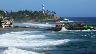
Kovalam Lighthouse Gets Elevator Facility

Introduction

True beauty of imposing scenery with the blue sea in the background was beyond the limit of people with little energy and old people. Those guys who were not bold and strong enough used to miss this mesmerizing view due to the steep stairs at the Lighthouse near the Kovalam beach in Trivandrum. The famous lighthouse has swirling stairs that take you to its top. These stairs take bends at sharp angles to increase the steepness in accordance with the lighthouse structure. Bearing this in mind, the Tourism Department has installed an elevator/lift for the benefit of the travellers flocking the known destination of Kerala in tourism circuit. In this blog post, we will highlight the new features of this elevator so that the readers visiting Kovalam can make use of this facility to climb to the top of the lighthouse to enjoy the scenery and the cool breeze emanating from the sea.

kovalam lighthouse

Lighthouse with Lift

The lift installation has been a long-pending demand of the people as many found it difficult to scale the height with the help of the swirling staircase to reach the top of the lighthouse. Only the energetic and athletic people could climb this steep staircase to reach the top. Yet, people did that exercise as they have something in store at the top. Heeding to the demand, the Tourism Department has decided to install the lift for the benefit of visitors to the Kovalam beach. Some days back, the Director General of Lighthouses and Lightships J.S. Chauhan formally commissioned the lift. With this new feature addition, Kovalam Lighthouse, officially known as Vizhinjam Lighthouse, has become fourth lighthouse in the country to have the lift attached. Previously, the lighthouses at Chennai, Thangasseri and Vypeen only had the elevator facility.

steep staircase

Lift Features at Kovalam Lighthouse

It is a cylindrical lift fitted in the well of the staircase to avoid the space consumption. A pre-fabricated glass enclosure surrounds the lift facility. The lift can carry about 5 people at a time. The total installation cost is about Rs. 80 lakh. The visitors can use the flight of stairs to reach the top also. While using the lift, the visitors can see the scenery as its sides have transparent glass walls. Hence, the users get a good view while going to the top. After reaching the top, the tourists will get the majestic view of the blue see skirting the beautiful cost of Kovalam. Other features of Kovalam and the Vizhinjam project area are also visible from the top of this lighthouse. With the elevator, commissioning the entry fee to the lighthouse has also been enhanced to Rs. 20 for adults and Rs. 10 for senior citizens, students and children.  The fee for carrying the camera is also enhanced to Rs. 10.

elevator facilty

Monday, 7 November 2016

6 Unconventional Accommodations for the Travel-geeks

Introduction

Many people harbor the intention to travel. However, some of them eventually venture out taking leave from the workplace and enjoy with family.  Others don’t get time to travel with the family as they have paucity of time and workload at the workplace. There are some others who are hardcore travelers who pick up the backpacks and venture out to know about the nature. This article is for those hardcore travelers who have become bored with the conventional stay-ins that they might have come across during their travels. They can look for the unconventional ones to satiate their wish to stay differently and comfortably.  Next time when they venture out, they can use this list as reference to pick up the one they like to stay, provided that type of accommodation is available at the destination.

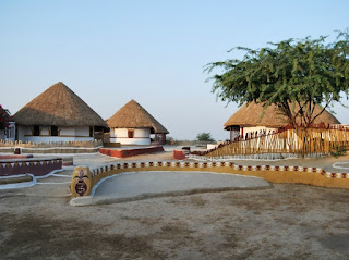
  1. Shaam-e-Sharhad Village Resort: This resort is at Hodka village in the Bhuj district of Gujarat. Located in the middle of nowhere, this resort is open from October to March every year. It has a range of hutments that take the travelers back to the rustic life. They can find eco-friendly tents to traditional bhungas or circular mud houses. Built under Endogenous Tourism Project or Rural Tourism Scheme, the cost of stay in these stay-ins for a night is from Rs. 3300 onward.

  2. shaam-e-shard village resort

  3. Sharnga Guest House: This accommodation is available at Auroville in a place called Bommapalayam in the southern state of Tamil Nadu. While staying in this guest house, the visitors can experience in a residential settings and tranquillity of natural surroundings. In the early morning, they can wake up to the chirping of birds and attend an early morning yoga session in the neighborhood. The cost per head for staying in this guest house is from Rs.1500 onward.

  4. sharnga guest house

  5. Tantra Beach and Shacks: It is situated at a place called Saint Michael Vado, near Anjuna Flea Market Path in Anjuna, Goa. This provides a tree-house type accommodation along with the hut options. The interior of this accommodation has tantric decor, arts, statues and colorful fabrics.  The visitors seeking stay in these shacks and huts can blend with the nature and fall into a gentle sleep listening to the sounds of Arabian Sea playing lullaby. The visitors need to fish out Rs. 1800 or more for their stay there.

  6. tantra beach goa

  7.  Houseboat: Though costlier when compared to other destinations discussed so far, Kerala’s houseboat provides an experience of lifetime. What is so special about this? The travelers can spend a night in total privacy in a gently floating houseboat in backwaters. Being waterborne, the setting gives cool and blissful experience if they sit just outside the launch in the houseboat. This is ideal for the honeymooners who want experience for their lifetime. They can hire a houseboat from either Alleppey or Kollam. The route the houseboat takes from Kollam to Alleppey is calm. The cost of the stay generally is on higher side and it is Rs. 6500 or more for a single person.

  8. houseboat kearal

  9. Guhantara Cave Resort:  It is India’s first underground cave resort. Situated just outside the Bangalore city, Guhantara resort provides an exhilarating experience of being inside a cave. The resort has all the infrastructure of a modern resort inside a cave-like setting. It has lounge bar, swimming pool, restaurant, kids’ play area, spa, and herbal garden. The water for the swimming pool comes from a waterfall. The water body within the cave plays host to different adventure sports activities. The cost of stay for a single person at night is from Rs. 8500 onward.

  10. guhandara resort bangalore

Sunday, 3 July 2016

Bhutan – the Land of Tranquillity and Natural Beauty


Introduction

Have you heard of the land of tranquillity? Yes, you have guessed it right. It is Bhutan. It is a landlocked country which is nestled in the eastern Himalayas. When tourists visit this country, true to its legend, they lose track of time. This is primarily due to the presence of serene nature, and colourful culture and tradition. The landlocked country is famously dotted with colourful dzongs and serene monasteries. In Bhutanese language, dzongs are nothing but small fortresses. Being a secluded country buried deep in the Himalayas, the culture and traditions grew different from the rest of the civilization in the Eastern region. In this blog, we will list out some of the best visited region in this country.

Bhutan
  1. Thimphu: This is the capital of Bhutan. This capital city is known for the presence of National Memorial Chorten where the people from the various parts of the country assemble to offer their prayers. The city is also home to the country’s revered monarchy. In fact, it is the only capital city in the world where there are no traffic lights to control vehicular movement. This primarily due to the absence of traffic jams on roads.

  2. national capital

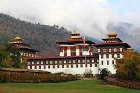
  3. Tashichho Dzong:  This beautiful little fort is situated to the north of the capital city Thimphu on the western banks of the river Wang Chu. It blends seamlessly well with the beautiful surrounding valley. Noted for the regal splendour, the dzong was once home to the National Assembly. It currently houses the secretariat, throne room, the offices of the monarch and ministries of home affairs and finance.

  4. natoinal assembly

  5. National Memorial Chorten: Located in the south-central part of the capital city, this impressive chorten is crowned by its golden spire. This memorial was built in 1974 to honour the third king Jigme Dorji Wangchuck. His Majesty is also known as the Father of Modern Bhutan.

  6. monastery

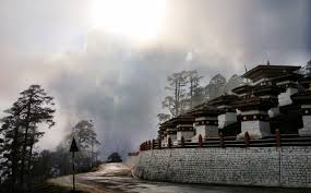
  7. Dochula Pass: It is situated at an elevation of 3100 meters from sea level. Travelers moving towards central Bhutan can have the spectacular views of the Himalayan mountain ranges at this pass, which is about 30 kilometres from the capital city. The fluttering colourful Buddhist prayer flags dotting the pass add more beauty to the scenery. The visitors can also see tall snow-capped trees standing in the surrounding valley.

  8. flags

  9. Paro Valley: It is surrounded by Himalayan ranges. The valley derives its name from a small and beautiful town that it surrounds. Paro town has many sites known in the international tourist circuit. They include Taktstang Monastery and the National Museum. The latter one is visited by thousands of visitors each year. Located at the northern end of the valley is the 7300-meter-high Mount Jomolhari. This mountain range looms over the town and is home to a glacier that feeds the Pachu River flowing through the valley.

  10. valley

  11. National Museum: This Paro-based museum is housed in a 17th century watchtower. The museum is home to numerous bronze statues, handicrafts and paintings that depict the history and cultural heritage of the country. These exhibits showcase 3000 works of Bhutanese art.

  12. museum

  13. Taktsang Monastery: It is built on a 3000-metre-high precipice. Hence, the visitors to this monastery have to take a treacherous winding path in the Paro Valley. However, it is a worth-taking exercise. On reaching the monastery, one can hear tranquil sounds of the prayers and chanting of Buddhist monks. It was originally built in the year 1692. There was a massive fire at the monastery in 1998 that charred the structure. Hence, it was rebuilt later to house the Buddhist monks and preserve their thousands-year-old customs.

  14. monastery

  15. Punakha Dzong: It is a 590-foot-long and 236-foot-wide dzong located in the Punakha Valley at the confluence of Pho Chu and the Mo Chu Rivers. Known also as Pungathen Dechen, the dzong is mainly divided into three courtyards. Cut away from the city nearby, the fort is bordered by tall Jacarandas trees. It famously hosts an annual Demoche festival in the month of February or March. This famous structure has withstood severe earthquakes and wild fire over the years.

  16. valley

Saturday, 23 April 2016

Nature and History Beckon Tourists to Sri Lanka

Introduction

Formerly known as Ceylon, Sri Lanka is a tear-shaped island-country situated south of the Indian peninsula. The island is well-known in the international tourist circuit for its lovely beaches, lush vegetation, monuments and cash-crop plantations. Moreover, the people of the country are known for their hospitality and love for the foreigners visiting their country. The place is also rich in historical monuments that talk about its glorious past.


Sri Lanka

Island Economy

Sri Lanka is dotted with lush scenery and dotted with plantations of coffee and tea. These plantations provide currency to propel the island-country's economy. The other bread winners for the country are the tourism industry. and heritage sites. It is blessed with lovely beaches and beautiful monuments. Being a Buddhist country, Sri Lanka has a lot of monasteries and monuments that are preserved by the monks. These specialties keep the island-nation active in the international tourism circuit. The country also gets money from fishing activities in the coastal region. Hence, the visitors to the island get a lot of opportunities to taste the mouth-watering seafood-based cuisines there.

island vegetation

Important Tourist Destinations

A trip to the island-nation starts with a visit to its capital Colombo. It is also called as the gateway to the island-nation. The capital is buzzing with modern metropolitan culture and hi-fi life. Hence, one can find the judicious mix of Colonial architecture and the modern designs in posh hotels, museums and cafes in the city.

destinations

Southern and Western Sides

As we leave the country capital, its rustic nature reveals itself to the tourists. Sri Lanka's most popular beaches can be located on its western side. Hence, one can find numerous hotels, beach resorts and other tourism avenues on the western coast. Some other well-known destinations in this island-country are Kalpitiya peninsula, Wilpattu National Park, Tangalla and Matara. On the southern coast is the quaint and attractive Galle. There are also other places of tourist interest beyond Matara, such as Tissamaharama, which is close to Yale and Bundala National Parks. 

natoinal park

Northern and Eastern Sides

There are plenty of tea and coffee plantations towards the northeast of Colombo, the gateway to Sri Lanka. The second largest city of the country Kandy is situated north of the Sri Lankan Capital. This city is home to the Temple of Tooth and most popular festival Esala Perahera. From this beautiful city, one can easily reach British-era town Nuwara Eliya that is home to Horton Plains National Park. The places of historical importance in the northern side of the island nation include Anuradhapura and Polonnaruwa. The cave temples of Dambulla are closer to the latter place.

temple of truth